

Hi guys,
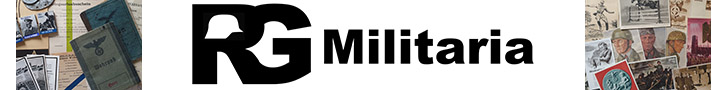
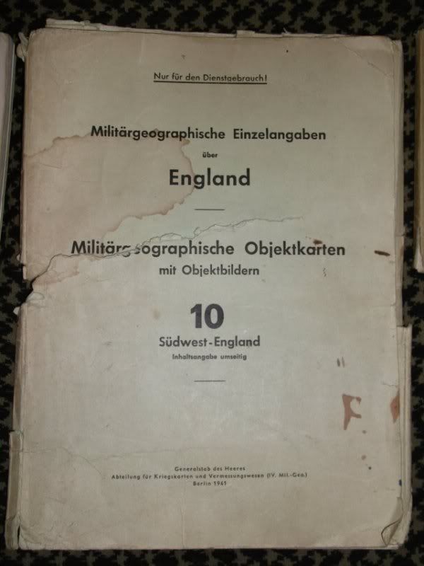
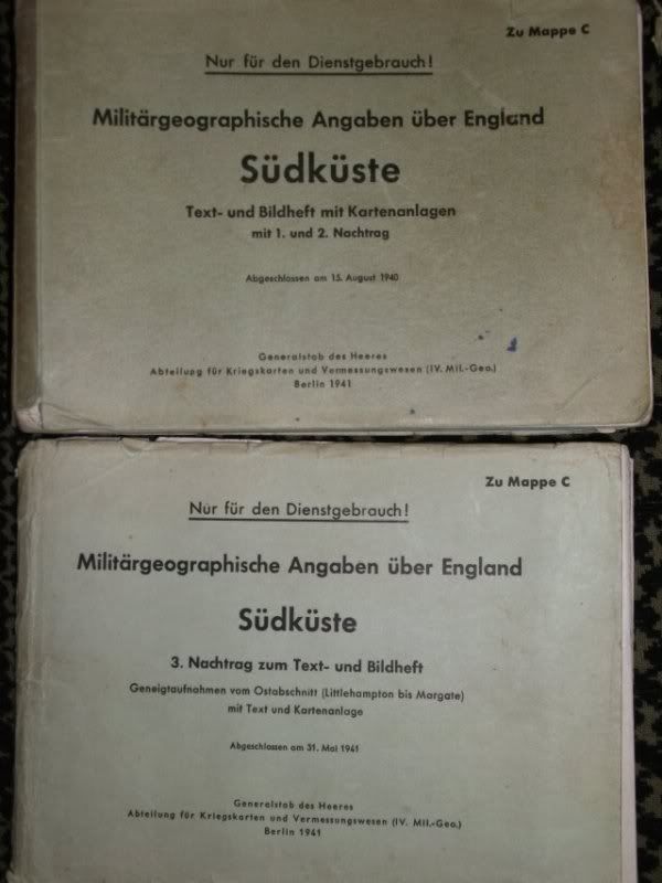
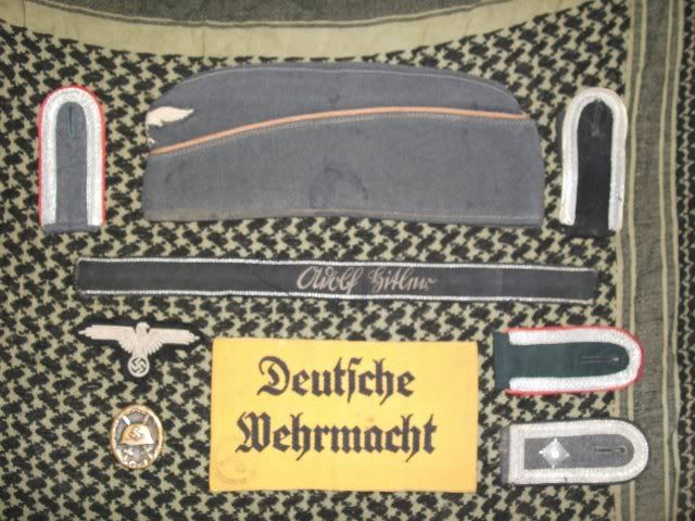
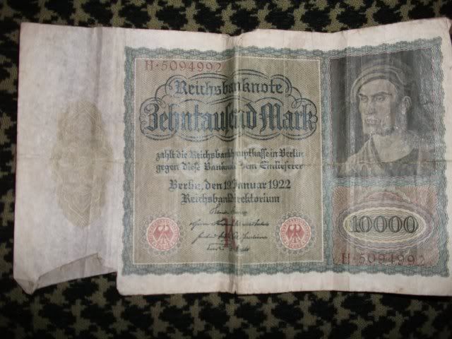
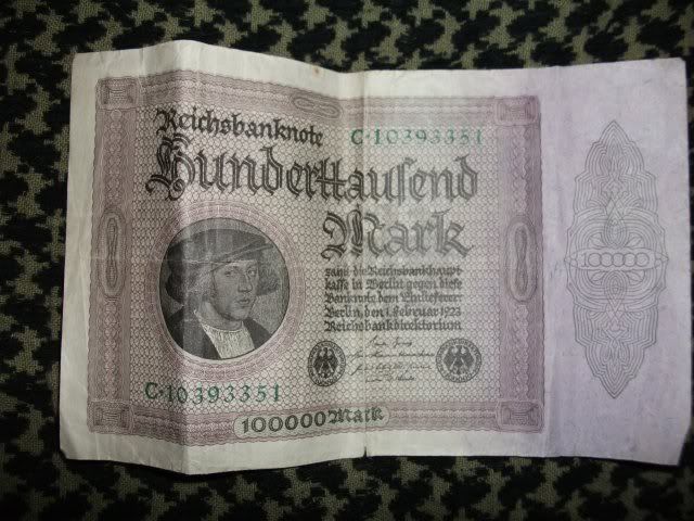
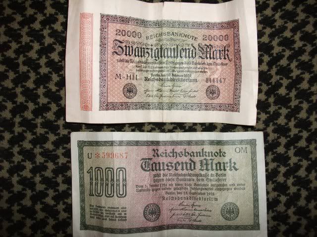
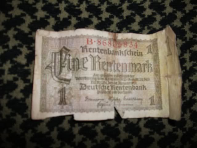
I was put onto this place by a mate of mine on a totally unrelated forum (Bushcrafting) as we recently had a thread on there about the coolest thinmgs we have ever found, i posted up that when my Gradfather died when i was 13 (many years ago now), we cleared out his house and the process found a lot and a mean a lot of WW2 related maps, caps, uniforms etc, therefore my mate thought it might be worth my while to post up a few pictures of what i have here in order to gather a bit more information on them, here's a few pics, appreciate any info you might be able to offer
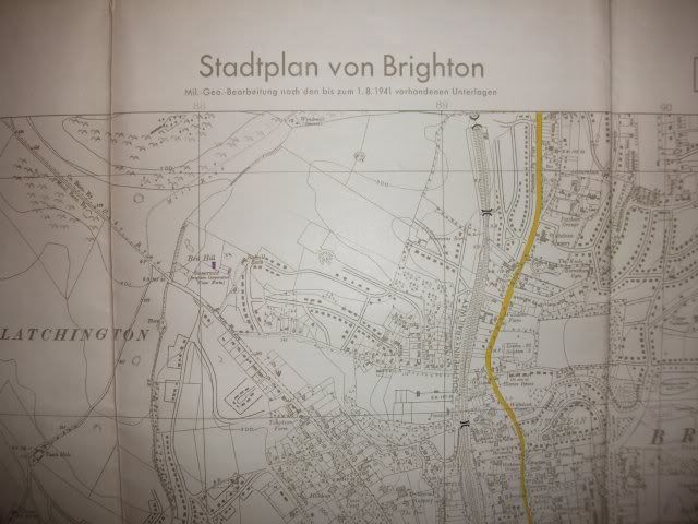
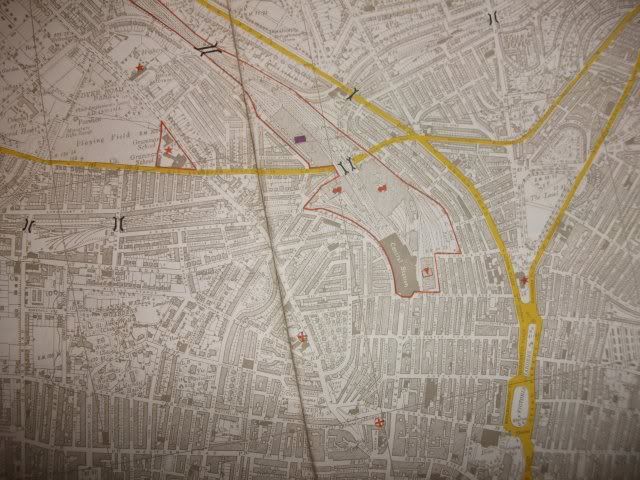
Detailed street map of Brighton, highlighting bridges, railways, gas works, hospitals etc
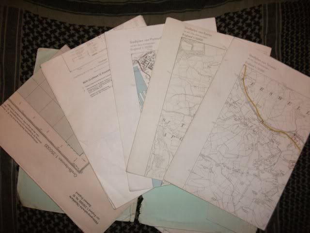
Detailed geological map of the entire south coast of England
More street maps of keys towns and cities in the South
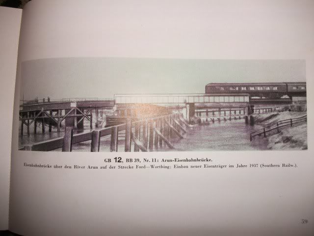
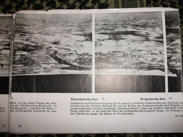
One of the booklets has detailed photographs of ALL the railway and road bridges around where i live, this bridge is still in existance and still carries the railway over the river, cant remember how many times ive been over it
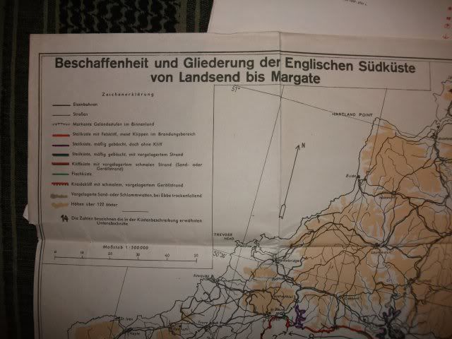
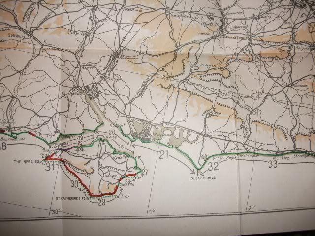
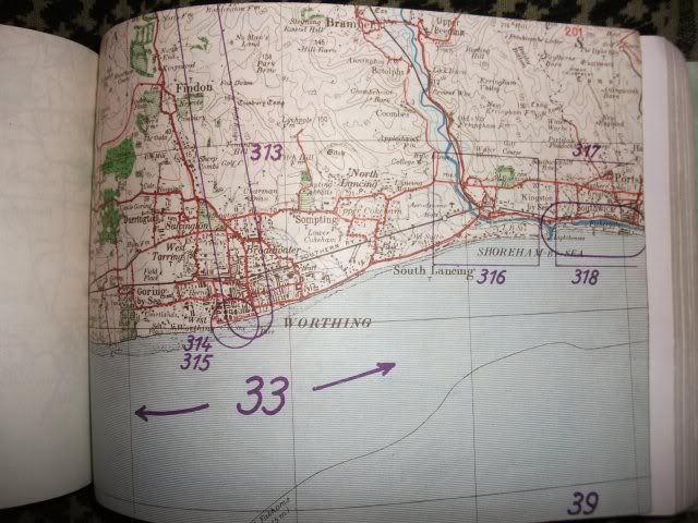
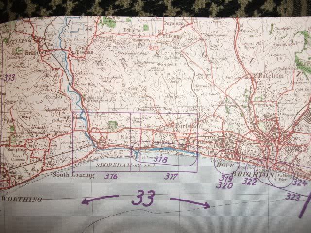
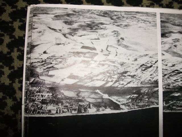
Detailed maps of the south coast
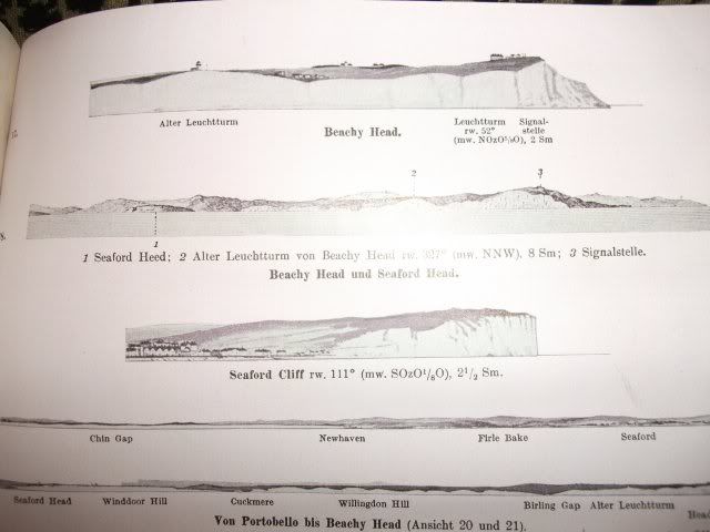
Including profiles of the cliffs
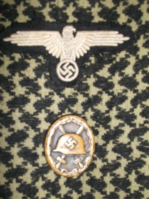
Hope this is of some interest, like i said would appreciate any info you guys might be able to give, especially ID of the epileutes and what part of the German Military they are from, as i simply do not know at this moment in time.
Thanks for looking


 wow, superb finds
 "In all my years as a soldier, I have never seen men fight so hard." - SS Obergruppenfuhrer Wilhelm Bittrich - Arnhem
Bookmarks