


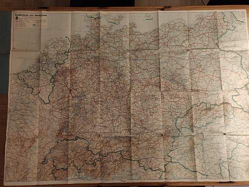
A while ago I managed to get a street map from 1941. It was published by the DDAC organization in Germany. The map is in reasonably good condition and unfortunately only has some nasty damage where an attempt has been made to de-nazifien the map (swastika cut out), but otherwise all tears from the folds.
What is already clear on the map is that there was a closed road network in Germany, but what I do not fully understand are the borders shown. For example, France is occupied, and thus included in Germany, but the Netherlands and Belgium seem to have a border. And for 1941 this would not be true. Can anyone shed some light on this?


The latter is for reference for occupancy.


Bookmarks